HydraPak E-Lite Contest!!
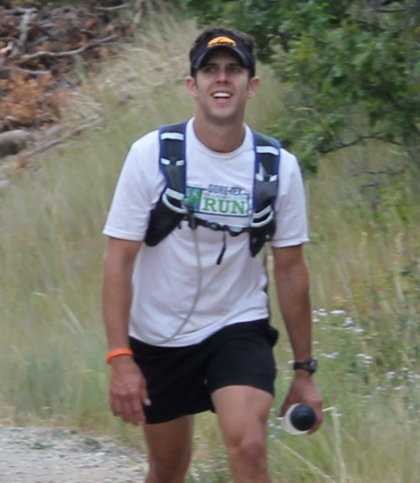
 After giving the Hydrapak E-Lite an inaugural run on the Wasatch 100. Not only was I completely satisfied and impressed with their product. But I would be more then happy to endorse it as a fitting light hydration pack for ultra runners in Utah and especially the Wasatch Front. So, I am happy to say that Hydrapak has been generous enough to provide a second for me to give away this month.
Here’s how to enter:
1. One point for subscribing to my Blog.
2. One point for every trail run recommendation in the state of Utah (multiple unique entries are encouraged)
3. Two points for Maps and beta for each route as above stated
4. One point for a personal story or description of each unique trail route
5. One point if you ‘Like’ Hydrapak on Facebook
Person with the MOST points wins the E-Lite
You may submit trail routes via comments on this post, emails, or even pony mail (if you want) no later then Oct. 15th!
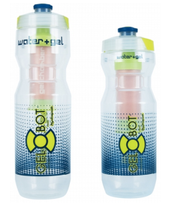
Second place will get the Gel-Bot.


Lately my favorite run has been a suffer-fest that I’ve deemed the ‘TriMangle’. It’s a pretty good way to get some good climbing in while still being able to use the car as a refueling point.
Starting from the Alta parking lot, run south through Albion Basin. Ascend to Catherine’s Pass to the east, and drop over the other side past Lake Mary and Dog Lake and descend all the way to the Brighton parking lot. Retrace your steps back to the pass and descend again to the upper-Albion lot. Re-ascend Albion Basin to Cecret Lake and then travel west to the top of Sugarloaf lift. Descend northward to the base of Alta, but cut to the west near the base of the Wildcat chair down-canyon to Snowbird. Once at the Cliff Lodge, begin climbing again, keeping toward the east side of Snowbird until reaching the base of the cirque. Ascend the east side of the cirque via the ridge trail until reaching Hidden Peak. Return to the car by following the ridgeline east and tagging Mount Baldy and then descending yet again through Alta. Total ascent is somewhere in the 12,000′ range and can vary widely based on the particular routes taken. Most climbing is on grades at least 15% and some grades can approach 40% or higher. The entire course is runnable if one is very fit.
Significant bonus points awarded for completing a double-loop on this course in a single day. I have yet to accomplish such a feat.
Variations include ascents of Sunset Peak, traversing across Catherine’s Area, or adding an additional loop across the Wolverine cirque at Brighton.
Mike, this sounds like a great run. I would love to join you for it one day. If you can send me a map, or even some images of the run.
I emailed over some photos and a map to you.
Cheers,
-mp
Weekly Update
Mike P. – 5 points
Laura H. – 1 point
Chad R. – 1 point
One month left…
My favorite summer trail loop I often use as my long run (I realize “long” is relevant–my long run is 15-20 miles).
Starting at the lower Big Water parking lot up Millcreek Canyon, I run up to Dog Lake, down and back up to Desolation Lake, then I take a left to follow the Great Western Trail back down to Big Water. This loop is about 13 miles. I often add to it by taking the Great Western Trail toward Brighton for a few miles for a little out and back action before I head back down to Big Water.
Laura,
This is perhaps one of the most beautiful and most popular runs in the Wasatch. For good reason. Feel free to email any photos, mapsetc. For more points. I will add this to the list of IME on the blog. Thanks and good luck.
My old standby is the Pipeline Trail up Millcreek Canyon. Burch Hollow to the overlook and back is about 9.4 miles and runable year round.
Another year round run (unless the snow has recently fallen) is the Jeremy Ranch road from Jeremy Ranch to Emigration Canyon and back. 13 miles round trip and in the winter I can run it in spikes and get in altitude training when many trails are unavailable.
Hello, this is a route that I recommend to all year conditions, people getting into trail running and a fall favorite. Are you recommend starting at Birch staying on the Pipeline to the Overlook and back? Send any of your favorite photos, maps , etc. For more points.
I also have a fun route starting at Rattlesnake going to Elbow, up to Bear pass, down to Lambs and returning.
There is also the Grandeur Fun Run loop popularized by the MRC-Ultra guys. Starts at the north end of Wasatch Drive, climbs Grandeur Peak on the west face, drops to Church Fork and then takes the Pipeline back down the canyon before climbing a very steep section that takes you back over and around to the start. Around 10 miles or so, but ~4,000′ of gain per loop. It’s not a beginners run.
There’s a map on their site somewhere. I’ve done a double-loop on the course at least once before. Contemplating attempting a triple but first I need to take some time off. :]
Yes always reliable. Also the beginning for he PieNBeer run.
A good winter run is the Desolation Trail in Millcreek. Its the first trailhead after Millcreek Inn. Switchbacks up 2.4 miles to a view of SLC. For some reason, I have yet to make it all the way to the overlook. I’ll blame it on the snow. I’d like to run it without snow and go a ways further sometime.This trail continues all the way to Desolation Lake.
I just ran the Glenwild loop off of Kimball Junction today. Its a nice 8.4 mile loop. A lot of sage brush, but also a lot of maples popping into red. There is also a little bit of climbing–around 1200 feet.
Thanks everyone for entering. Remember you can get more points for submitting photos, maps, etc.
I will be posting an update to the points total on Oct. 1st.
Hello
With just a few days left, here are the totals thus far
Laura H. – 13 points
Mike P. – 8 points
Tarzanphan60 – 3 points
Chad R. – 1 point
5 days left….
CONGRATULATIONS!
Laura has won the HydraPak.
Mike has won the Gel-Bot
Send me an email with your contact info and I will be sure to get you these prizes ASAP.
Thank you to everyone who participated.
Please keep me updated on who this site can better serve the trail running community in Utah!!!!
Pete, I like simplicity. One of my Wasatch prep runs is to start in downtown SLC and run up City Creek to City Creek Pass. It involves a mile or so of bushwacking but also some clean running water to fill up bottles a mile or two before the pass. At the pass, follow the Wasatch course south, and reload the stomach and bottles with water at Alexander Springs (sometimes there are berries around here). Continuing along the course, I fill up again at Lambs just before hitting the trail (I didn’t get sick from it). At Elbow fork, leave the Wasatch course and follow the Pipeline trail down Mill Creek Canyon. I got rather dehydrated and filled up with water at the stream at Church Fork (I didn’t get sick). Take Rattlesnake Gulch down, but then have to suffer on the road a bit to get to Dan’s Food store. I planned ahead and had my credit card to buy whatever food looked good! Also, I had my bus pass to take the 33 bus to the trax line to get back downtown. No car shuttle needed, and if you live in downtown, no car needed at all. I used the bus schedule to motivate me to finish the run in time to shop and still catch the bus.